Exhibition marks centennial of passage
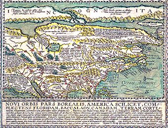
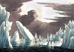
Princeton NJ -- An exhibition documenting the centennial of transit through the Northwest Passage will be on display April 4 through Sept. 26 in Firestone Library's Milberg Gallery. For 400 years, beginning in the 1500s, explorers sought a navigable channel through the Canadian Arctic in search of a shorter route to the Orient. However, the full transit was not completed until Norwegian adventurer Roald Amundsen's journey from 1903 to 1906. "Of Maps and Men: In Pursuit of a Northwest Passage" will include early expedition journals of the British explorers Sir John Ross, Sir William Edward Parry and Sir John Franklin, who discovered and named most of the geographic elements of the Canadian Arctic, as well as enlarged copies of photographs taken during a summer 2003 transit aboard a Russian icebreaker which document the 3,000-mile passageway as it appears today. It also features historical maps, including the "first Arctic map" (1595) by Gerhard Mercator, and rare books in the field of discovery. The exhibition is curated by John Delaney, curator of historic maps in the library. For hours and tour information, visit the library Web site at <Web site>. |
Contents |
|||||